EL NINO AND LA NINA
- El Niño and La Niña, translating to “little boy” and “little girl” in Spanish, are climatic events arising from interactions between the ocean and atmosphere. They influence water temperatures in the central and eastern tropical Pacific Ocean, thereby affecting global weather patterns.
- The Earth's rotation from east to west causes winds between 30 degrees north and south of the equator to tilt in their paths. This results in winds flowing southwest in the northern hemisphere and northwest in the southern hemisphere, a phenomenon known as the Coriolis Effect.
- Consequently, trade winds blow westward on either side of the equator. Typically, these winds move west from South America towards Asia, leading to upwelling, where cold water from beneath the ocean surface rises, replacing warmer surface waters.
- Occasionally, weakened trade winds shift back towards South America, preventing upwelling. This leads to warmer-than-normal sea surface temperatures along the equatorial Pacific Ocean, marking the onset of El Niño conditions.
- In contrast, during La Niña, stronger trade winds push warm water towards Asia, enhancing upwelling and bringing cold, nutrient-rich water to South America.
- Thus, El Niño and La Niña represent opposite phases of the El Niño Southern Oscillation (ENSO) cycle, which also includes a neutral phase.
- El Niño events are more common than La Niña ones, occurring every two to seven years when neutral ENSO conditions are disrupted by either phase. Recently, La Niña conditions were observed from 2020 to 2023
.jpg)
- Due to ENSO and the associated changes in ocean temperatures, air circulation in the region is also influenced. This, in turn, affects precipitation levels in nearby areas and has an impact on the Indian monsoon.
- The current El Niño event, which started last June, has weakened considerably. It is anticipated that by June, neutral ENSO conditions will be in place. Following this, La Niña conditions are expected to develop, potentially starting to have an impact by August
- Like India, countries such as Indonesia, the Philippines, Malaysia, and their neighbors experience abundant rainfall during a La Niña year. This year, Indonesia has already experienced flooding.
- Conversely, droughts are common in the southern parts of North America, where winters tend to be warmer than usual.
- Canada and the northwestern coast of the United States face heavy rainfall and flooding. Southern Africa experiences above-average rainfall, while the eastern regions of the continent receive below-average rainfall.
- ENSO significantly influences hurricane activity over the Atlantic Ocean, with La Niña years typically seeing an increase in hurricanes. For example, in the La Niña year of 2021, the Atlantic Ocean saw a record 30 hurricanes
- In India, El Niño is known to reduce southwest monsoon rainfall, leading to higher temperatures and more intense heatwaves, as seen this summer.
- Historically, monsoon seasons following an El Niño, such as in 1982-1983 and 1987-1988, saw abundant rainfall in 1983 and 1988. A similar pattern may occur this year.
- From 2020 to 2023, the longest La Niña event of the century took place. This was followed by ENSO neutral conditions, which transitioned to El Niño by June 2023.
- However, El Niño has been weakening since last December. According to Rajeevan, this rapid shift to La Niña is a natural occurrence and has happened many times in the past.
- Scientists suggest that climate change will impact the ENSO cycle. Various studies indicate that global warming may alter the average oceanic conditions in the Pacific Ocean, leading to more frequent El Niño events.
- The World Meteorological Organization (WMO) also predicts that climate change will likely affect the intensity and frequency of extreme weather and climate events associated with El Niño and La Niña
|
For Prelims: Indian and World Geography
For Mains: GS-I, GS-III: Important Geophysical phenomena and environment
|
WESTERN GHATS - LANDSLIDES

- Experts agree that multiple factors contribute to landslides, both natural and human-induced. Nearly half of Kerala’s land—19,301 sq km or 49.7%—is susceptible to landslides, according to the Geological Survey of India (GSI).
- The region’s heavy rainfall and the steep slopes of the Western Ghats make Wayanad particularly vulnerable, with 31.54% of the district at high risk, as per IIT-Delhi research.
- Human activities have heightened the risk of natural disasters; increased construction and changes in agricultural practices are key contributors.
- Wayanad has seen a tourism boom in recent years, with homestays and monsoon tourism gaining popularity. Ecologist Madhav Gadgil highlights the construction of resorts, artificial lakes, and abandoned quarries as inappropriate developments in this sensitive zone.
- Long-term land use changes, beginning with British-era tea plantations and continuing post-Independence, have also played a role.
- A 2022 study in the International Journal of Environmental Research and Public Health reported a 62% decrease in forest cover and an 1,800% increase in plantation areas from 1950 to 2018. Monocropping has led to the destabilization of topsoil previously held by forest roots.
- Climate change has indirectly contributed by altering rainfall patterns in the state. The warming Arabian Sea fosters deep cloud systems, resulting in intense rainfall over short periods.
- Such events have become more frequent even as the number of rainy days during the monsoon has decreased.
- Despite Wayanad receiving 527 mm of rainfall in 48 hours before the landslide, the district has had normal monsoon rainfall averages, while Kerala has experienced deficits, according to the India Meteorological Department.
- The previously cool, humid environment with consistent drizzles and monsoon rains is now characterized by hotter, drier summers and intense monsoon downpours.
- This shift increases landslide risks, as dry soils absorb less water and heavy rains cause runoff, leading to landslides
- Kerala experiences intense monsoon rains, which can lead to flooding and landslides. The Western Ghats, with their steep slopes, are particularly prone to such events
- The topography of regions like Wayanad, which have a significant slope, makes them highly susceptible to landslides
- Changes in climate patterns have resulted in more intense and concentrated rainfall events, even though the overall number of rainy days has decreased. The warming Arabian Sea has contributed to the formation of deep cloud systems that lead to heavy downpours
- There has been a significant reduction in forest cover due to plantation agriculture and other developmental activities. This loss of vegetation weakens the soil structure, making it more prone to landslides
- Unregulated construction, including resorts, homestays, and other infrastructure, has destabilized the land. Inappropriate development in sensitive zones, such as the construction of artificial lakes and abandonment of quarries, has exacerbated the risk.
- Changes in crop patterns, including the shift to monocropping, have degraded the land. Monocropping loosens the topsoil, which was previously held together by the roots of diverse forest plants
- The rise in tourism, particularly monsoon tourism, has led to increased construction and human activity in vulnerable areas, further destabilizing the environment
- Long-term changes in land use, starting with British-era tea plantations and continuing in the post-independence era, have had a lasting impact on the region's ecological stability
- Ecologically Sensitive Zones (ESZ): The committee proposed classifying the entire Western Ghats into three zones based on their ecological sensitivity:
- ESZ 1: Highest sensitivity areas where stringent regulations should apply.
- ESZ 2: Moderate sensitivity areas with moderate regulations.
- ESZ 3: Lowest sensitivity areas where the least restrictive regulations would apply
- Ban on Certain Activities in ESZ 1: Activities such as mining, quarrying, and large-scale constructions should be banned in ESZ 1. Deforestation and conversion of public lands for private purposes should also be prohibited.
- Regulation of Developmental Activities: Developmental activities in ESZ 2 and ESZ 3 should be carefully regulated to ensure they do not harm the environment. This includes control over tourism, infrastructure projects, and industrial activities
- Protection of Forests: Emphasis on the conservation and regeneration of natural forests. Plantation activities should be eco-friendly, promoting native species.
- Biodiversity Conservation: Measures to protect the rich biodiversity of the Western Ghats, including the establishment of wildlife corridors and conservation areas.
- The Western Ghats are one of the world's eight "hottest hotspots" of biological diversity. They host over 7,400 species of flowering plants, 139 mammal species, 508 bird species, 179 amphibian species, 6,000 insect species, and 290 freshwater fish species, many of which are endemic.
- A significant proportion of the species found in the Western Ghats are endemic, meaning they are not found anywhere else in the world. This includes many unique species of plants, animals, and microorganisms
- The region provides crucial ecosystem services, such as water purification, climate regulation, soil stabilization, and carbon sequestration
- The Western Ghats play a critical role in the Indian monsoon system. They intercept the moisture-laden winds from the southwest, causing heavy rainfall on the western side, which supports lush forests and agriculture
- The forests of the Western Ghats act as a climate buffer, moderating temperatures and maintaining regional climate stability
- The Western Ghats are the source of numerous rivers, including the Godavari, Krishna, and Cauvery, which provide water to millions of people in peninsular India. These rivers are crucial for drinking water, irrigation, and hydropower
- The Western Ghats are home to numerous indigenous communities and tribal groups who have lived in harmony with the environment for centuries. These communities have rich cultural traditions and knowledge systems linked to the forests and biodiversity
- Many areas in the Western Ghats are considered sacred by local communities and host numerous temples, shrines, and pilgrimage sites.
- The Western Ghats support diverse agricultural systems, including spice plantations (pepper, cardamom), tea, coffee, and rubber. These crops are economically significant both domestically and for export
|
For Prelims: Western Ghats, Eastern Ghats, Landslides, Flash floods
For Mains: GS 1 - Indian Geography
|
Previous year questions
|
1. Which of the following statements in respect of landslides are correct? (NDA 2022) 1. These occur only on gentle slopes during rain.
2. They generally occur in clay-rich soil.
3. Earthquakes trigger landslides.
Select the correct answer using the code given below. A. 1 and 2 B. 2 and 3 C. 1 and 3 D. 1, 2 and 3 Answer: (B) For Mains: 1. Describe the various causes and the effects of landslides. Mention the important components of the National Landslide Risk Management Strategy. (250 words) (2021)
|
SOUTHWEST MONSOON
- The southwest monsoon is a seasonal weather pattern that brings significant rainfall to large parts of South Asia, particularly India, between June and September
- The southwest monsoon typically begins in early June and lasts until late September. It starts with the arrival of the monsoon winds in the southern part of India, usually marked by the onset over the state of Kerala
- The southwest monsoon brings about 70-90% of India’s annual rainfall. The distribution of rainfall varies, with some regions receiving heavy rains, while others may experience scanty showers.
- The Western Ghats, the northeastern states, and the Himalayan foothills typically receive very heavy rainfall.
- The monsoon is critical for the Kharif crop season in India, which includes crops like rice, maize, pulses, and cotton. Adequate and timely monsoon rains are essential for a good harvest
- The monsoon starts retreating from northwestern India in early September and completely withdraws from the Indian subcontinent by mid-October. This phase is also known as the retreating or northeast monsoon
Mechanism:
- High-Pressure Area: During the summer, intense heating of the landmass in the Indian subcontinent creates a low-pressure area over northern India and the Tibetan Plateau.
- Low-Pressure Area: The Indian Ocean remains relatively cooler, creating a high-pressure area.
- Wind Movement: Air moves from the high-pressure area over the ocean to the low-pressure area over the land, carrying moisture from the ocean and resulting in rainfall.
- Easterly and westerly winds refer to the direction from which the winds originate
- Easterly winds are winds that blow from the east towards the west
- Easterly winds can affect weather patterns, including the development of tropical storms and cyclones. For instance, easterly waves in the tropics can lead to the formation of tropical cyclones in the Atlantic and Pacific Oceans
Characteristics:
- Trade Winds: One of the most well-known examples of easterly winds are the trade winds. These winds blow from the east towards the west in the tropics, from the subtropical high-pressure areas toward the equatorial low-pressure areas.
- Tropical Regions: In the tropical regions, particularly between 30 degrees north and south of the equator, easterly winds are prevalent. These are crucial for the weather patterns and climatic conditions in these regions.
- Monsoon Winds: During certain seasons, such as the northeast monsoon in India, easterly winds play a significant role. These winds bring dry air from the land towards the ocean during the winter months.
- Westerly winds are winds that blow from the west towards the east
- Westerly winds play a significant role in the weather of temperate regions, influencing the climate and the movement of storm systems.
- They are also responsible for carrying warm and moist air from the oceans inland, affecting precipitation patterns in coastal and inland regions.
- The westerlies can affect transoceanic travel and weather prediction due to their influence on the movement of high and low-pressure systems
Characteristics:
- Prevailing Westerlies: These winds are predominant in the mid-latitudes (between 30 and 60 degrees north and south of the equator). They blow from the subtropical high-pressure belts towards the poles.
- Jet Streams: High-altitude westerly winds known as jet streams are important in influencing weather patterns and the movement of weather systems across the globe. They are fast flowing and occur in the upper levels of the atmosphere.
- Polar Front: In the mid-latitudes, the westerlies interact with polar easterlies near the polar front, leading to the development of extratropical cyclones and storms
.jpg)
Monsoons in India occur due to seasonal changes in wind patterns and temperature differences between land and sea.
Here's a concise explanation of the process:
- Differential heating: During summer, the Indian landmass heats up more quickly than the surrounding Indian Ocean.
- Low pressure system: The heated land creates a low-pressure area over the Indian subcontinent.
- Wind direction shift: This low pressure draws in moisture-laden winds from the cooler Indian Ocean towards the land.
- Orographic lift: As these winds encounter geographical features like the Western Ghats or the Himalayas, they are forced to rise.
- Condensation and precipitation: The rising air cools, causing water vapor to condense and form clouds, leading to heavy rainfall.
- Duration: This pattern typically lasts from June to September, bringing the majority of India's annual rainfall.
- The primary driver is the temperature difference between the land and the surrounding sea. During summer, the land heats up faster than the ocean, creating a low-pressure area over the land and a high-pressure area over the ocean. This pressure difference leads to the movement of moist air from the ocean to the land
- Warm sea surface temperatures are crucial as they increase the evaporation rate, contributing to the formation of moist air masses that drive the monsoon rains.
- The monsoon winds, which are part of the larger atmospheric circulation, shift according to the seasonal temperature differences. The southwest monsoon, for instance, is driven by the southwest winds that carry moisture from the Indian Ocean to the Indian subcontinent.
- The geographical features, such as mountain ranges, play a significant role. For example, the Western Ghats in India force moist air to rise, cool, and condense, leading to heavy rainfall on the windward side
- The movement and strength of the high-pressure systems over the oceans and low-pressure systems over the land influence the intensity and timing of the monsoon.
- Phenomena such as El Niño and La Niña can affect the strength and timing of the monsoon. For example, El Niño can lead to weaker monsoons due to altered wind patterns and sea surface temperatures
- El Niño is generally associated with a weaker Indian monsoon. The warming of the central and eastern Pacific Ocean during El Niño tends to disrupt the normal atmospheric circulation patterns, leading to reduced rainfall over the Indian subcontinent.
- The onset of the monsoon can be delayed, and the overall intensity of the rainfall during the monsoon season might be lower than usual
- El Niño often brings drier conditions to Southeast Asia and northern Australia, leading to droughts and reduced rainfall
- Eastern and southern Africa may experience drier conditions as well
- La Niña, characterized by cooler-than-average sea surface temperatures in the central and eastern Pacific Ocean, is typically associated with a stronger Indian monsoon. It often leads to increased rainfall over the Indian subcontinent
- The enhanced monsoon can lead to heavier rains and potentially more frequent and intense flooding
- La Niña tends to bring wetter conditions to Southeast Asia and northern Australia, potentially causing heavy rains and flooding
- La Niña can lead to wetter conditions in parts of northern South America
|
For Prelims: Indian and World Geography
For Mains: GS-I, GS-III: Important Geophysical phenomena and environment
|
|
Previous Year Questions
1.Consider the following statements: (UPSC CSE 2012)
1. The duration of the monsoon decreases from southern India to northern India.
2. The amount of annual rainfall in the northern plains of India decreases from east to west.
Which of the statements given above is/are correct?
A. 1 Only
B. 2 Only
C. Both 1 and 2
D. Neither 1 nor
Answer (C)
|
FOREST RIGHTS ACT
1. Context
2. Key Points
- The ST Commission is caught in a row with the Union Environment Ministry over the latest Forest Conservation Rules (FCR), 2022.
- The row is over the potential violation of provisions enshrined in the Scheduled Tribes and Other Forest Dwellers (Recognition of Forest Rights) Act, 2006 was dubbed the Forest Rights Act (FRA).
3. The involvement of NCST in the Act
- The Ministry of Environment, Forests and Climate Change in June 2022 notified the forest (Conservation Rules, 2022, which prescribed the mechanism for the diversion of Forest land for non-forest purposes.
- These amended rules have omitted a clause (Present in 2014 and 2017 Rules) that explicitly required any proposal to mandatorily have the consent of local tribespeople and Other Traditional Forest Dwellers (OTFDs) of the area, before proceeding for Stage 1 clearance.
- The FCR, 2022 has allowed applying entities to go for the consent of locals, represented by the Gram Sabha after Stage 1 or even after Stage 2 clearance.
- According to the FRA, 2006, in case of a dispute over forest land, precedence has to be given to the rights of STs and OTFDs, who live in and off the forest and its resources, over any other party.
4. NCST demands
- In September 2022, NCST Chairperson Harsh Chouhan shot off a letter to Environment Minister Bhupendra Yadav, highlighting the potential consequences of FCR, 2022, recommending that they be put on hold and the previous Rules, which provided for the consent clause, be strengthened.
- The ST panel argued that the previous versions of the Rules provided a legal space for ensuring the completion of the processes for recognition and vesting of rights under the FRA in areas where forests are being diverted.
- The ST Commission noted that it made little sense to take the consent of tribals and forest dwellers after an applicant had got Stage 1 clearance.
|
By then, the applicant would be invested in the project and would then have the incentive to "pursue the State It said governments or Union Territories" to divert the land at the earliest.
The NCST added that the FCR, 2022 provided for compensatory Afforestation, but nowhere did it prescribe safeguards or a mechanism for compliance with FRA.
|
- Further, the NCST's Working Group found that FRA compliance was in trouble even under the old rules.
It said currently, nearly 25, 000-30, 000 hectares of forest land were being diverted every year. - It cited a study by the Centre for Environment and Development, ATREE to note: " Out of 128 applications for forest diversion for mining, over 100 had been processed between 2009 and 2018".
- It added that 74 proposals had Stage 2 approval, 46 had Stage 1 approval (in principle), with just five rejected and four closed for other reasons.
- None of the rejections was for non-compliance with FRA.
- The study also found that 14 of these cases (all post-2014) had been cleared with an FRA compliance report, despite, this being far from the "ground reality".
5. About NCST
- The National Commission for Scheduled Tribes is a constitutional body that was established by the Constitution (89th Amendment) Act, 2003.
- The Commission is an authority working for the economic development of Scheduled Tribes in India.
- National Commission for Scheduled Castes (NCSC)
- National Commission for scheduled Tribes (NCST)
|
Article 366 (25) of the Constitution, Scheduled Tribes are those communities that are scheduled in by article 342 of the Constitution.
Also, Article 342 of the Constitution says that: The Scheduled Tribes are the tribes or tribal communities or part of or groups within these tribes and tribal communities which have been declared as such by the President through a public notification.
|
5.1. Composition of NCST
- The NCST consists of one chairperson, one vice-chairperson and three full-time members.
- Out of the three members, there should compulsorily be one lady member.
- Tenure of the members is 3 years.
5.2. Functions of NCST
- It investigates and monitors issues related to safeguarding the provisions for Scheduled Tribes under the Constitution and evaluating the working of those safeguards.
- NCST will inquire into specific complaints concerned with the deprivation of rights and safeguards of the STs.
- The commission participates and advises on the planning process for the socio-economic development of the STs and also evaluates the progress of the various developmental activities.
- The President will be presented with an annual report on the working of those safeguards.
- Apart from annual reports, other reports also will be submitted to the President as and when necessary.
- The Commission will also give reports on what measures are to be taken by both the central and various state governments for the effective execution of the measures and safeguards for the protection, development and welfare of the STs.
- Other functions of NCST are related to the welfare, protection, development and advancement of the STs.
6. Forest Rights Act
- The Scheduled Tribes and Other Traditional Forest Dwellers (Recognition of Forest Rights) Act, commonly known as the Forest Rights Act of India, is often referred to as the Tribal Rights Act or the Tribal Land Act.
- It was enacted in 2006 and recognises the rights of tribal communities that live in the forest as well as other traditional forest dwellers to the forest resources that were essential to their ability to provide for a variety of needs, including subsistence, habitation and other sociocultural requirements.
- The forest management policies, including the Acts, Rules and Forest Policies of Participatory Forest Management policies in both colonial and post-colonial India, did not, till the enactment of this Act., recognize the symbiotic relationship of the STs with the forests, reflected in their dependence on the forests as well as in their traditional wisdom regarding conservation of the forests.
| The Act encompasses Rights of Self-cultivation and Habitation which are usually regarded as Individual rights; and Community Rights such as Grazing, Fishing and access to Water bodies in the forest, Habitat Rights for PVTGs, Traditional Seasonal Resources access to Nomadic and Pastoral Communities, access to biodiversity, community right to intellectual property and traditional knowledge, recognition of traditional customary rights and right to protect, regenerate or conserve or manage any community forest resource for sustainable use. |
- It also provides rights to the allocation of forest land for developmental purposes to fulfil the basic infrastructural needs of the community.
- In conjunction with the Right to Fair Compensation and Transparency in Land Acquisition, Rehabilitation and Settlement Act, 2013 FRA protects the tribal population from eviction without rehabilitation and settlement.
-
The Act further enjoins upon the Gram Sabha and rights holders the responsibility of conservation and protection of bio-diversity, wildlife, forests, adjoining catchment areas, water sources and other ecologically sensitive areas as well as to stop any destructive practices affecting these resources or cultural and natural heritage of the tribals.The Gram Sabha is also a highly empowered body under the Act, enabling the tribal population to have a decisive say in the determination of local policies and schemes to impact them.
-
Thus the Act empowers the forest dwellers to access and use the forest resources in the manner that they were traditionally accustomed, to protect, conserve and manage forests, protect forest dwellers from unlawful evictions and also provides for basic development facilities for the community of forest dwellers to access facilities of education, health, nutrition, infrastructure etc.
6.1. Objective
- To undo the historical injustice that occurred to the forest-dwelling communities
- To ensure land tenure, livelihood and food security of the forest-dwelling Scheduled Tribes and other traditional forest dwellers
- To Strengthen the conservation regime of the forests by including the responsibilities and authority of Forest Rights holders for sustainable use, conservation of biodiversity and maintenance of ecological balance.
For Prelims & Mains
|
For Prelims: Forest Rights Act, NCST, NCSC, Forest Conservation Rules 2022, Traditional Forest Dwellers,
For Mains:
1.Discuss the powers and functions of the National Commission for Scheduled Tribes in protecting the rights of the Forest-dwellers in India. (250 Words)
|
NATIONAL CLEAN AIR PROGRAM (NCAP)
2. Abour National Clean Air Programme (NCAP)
The National Clean Air Programme (NCAP) was initiated by the Indian government to address the alarming levels of atmospheric pollution, particularly the concentration of Particulate Matter (PM). Under NCAP, cities in India exceeding annual PM levels are required to develop and execute Clean Air Action Plans (CAAPs) annually. To support this initiative, the Ministry of Environment, Forest, and Climate Change has allocated ₹10,422.73 crore.
Challenges in NCAP Implementation
Despite the proactive submission of CAAPs by most cities, the implementation of NCAP has faced inconsistencies. According to the Ministry, only 60% of the allocated funds have been utilized on average, with 27% of cities spending less than 30% of their designated budgets. Notably, cities like Visakhapatnam and Bengaluru have spent minimal percentages of their NCAP funds, hindering progress.
Barriers to Implementation
- Delays in implementation primarily stem from bureaucratic hurdles and a lack of standard operating procedures.
- Approval delays from competent authorities, such as technical specifications for tendering processes and procurement of necessary equipment like mechanical sweepers and electric buses, have been significant impediments.
- Additionally, the absence of well-defined timelines and time-consuming tasks further exacerbate delays.
- Overcoming these challenges requires a systematic approach integrating Emissions Inventory (EI), Air Quality (AQ) modelling, and Source Apportionment (SA).
- Recent findings questioning the efficacy of outdoor smog towers have also fueled doubts among decision-makers, necessitating a comprehensive reevaluation of proposed mitigation measures.
3. Role of Scientific Tools in Pollution Management
Scientific tools play a crucial role in addressing air pollution challenges, particularly in identifying and understanding its origins.
- EI studies provide valuable insights into local pollution sources and their contributions, enabling experts to forecast future emissions and shape targeted pollution control strategies.
- Despite their usefulness, EI studies have limitations, especially in assessing the impact of transboundary pollution sources, such as stubble burning outside Delhi, on local air quality.
- SA studies offer detailed analyses of contributions from various pollution sources, including distant ones.
- However, they lack predictive capabilities and require substantial resources for chemical analysis.
- Additionally, SA studies struggle to differentiate between pollution origins with similar chemical signatures, such as emissions from diesel trucks nearby versus those further away.
- AQ modelling bridges gaps left by EI and SA studies by informing our understanding of pollution dispersion, including from distant sources.
- By simulating the movement of pollutants in the atmosphere, AQ modelling enhances our ability to assess and mitigate air pollution's impacts.
4. Utilization of Scientific Data in Air Pollution Management
- Cities ideally utilize Emissions Inventory (EI) and Source Apportionment (SA) data to identify air pollutants and devise targeted mitigation measures for each polluting activity.
- However, according to the Portal for Regulation of Air Pollution in Non-Attainment Cities, only 37% of cities have completed EI and SA studies, leaving 63% without a clear understanding of their air pollution sources.
- This lack of data raises concerns about the effectiveness of Clean Air Action Plans (CAAPs), as cities may not accurately gauge the emission reduction potential of proposed measures.
- To address this, cities must establish proper yearly targets based on their potential and infrastructure capabilities.
Challenges and Considerations
- The reliance of the National Clean Air Programme (NCAP) on concentration data, which measures population exposure to pollution, adds complexity.
- Pollution from high-emitting industries and sources beyond city limits, transported into urban areas by wind, complicates urban air quality management.
- Additionally, many existing control measures primarily target primary PM emissions, overlooking their secondary precursors.
- There's a need for a shift towards comprehensive strategies addressing both primary and secondary pollutants.
- Furthermore, while NCAP aims to establish infrastructure for air quality forecasting, only a few cities like Delhi, Pune, Mumbai, and Ahmedabad have implemented decision-support systems.
- Implementing such systems across cities is crucial for timely and effective pollution management.
5. Key Factors for NCAP Success
The success of the National Clean Air Programme (NCAP) relies on several critical elements beyond just data and models.
- Efficient implementation on the ground is paramount. To achieve this, implementation agencies must streamline bureaucratic processes by adopting shared, standardized technical evaluations. This will expedite the execution of NCAP initiatives and ensure timely action on pollution reduction measures.
- Given that NCAP funding is tied to cities' performance in reducing annual average PM concentrations, proactive budgeting and meticulous time management are essential. Initial plans should encompass thorough assessments of technical feasibility, budget requirements, and timeframes to facilitate successful execution.
- NCAP's vision for cleaner air in India necessitates a multifaceted approach. Success requires integrating rigorous scientific studies, strategic allocation of funds, and prompt, efficient implementation of mitigation measures.
6. The Way Forward
The successful implementation of the NCAP requires concerted efforts to address challenges, utilize scientific data effectively, and adopt a comprehensive approach towards pollution management. By addressing these key factors, India can make significant progress towards achieving cleaner air for its citizens.
|
For Prelims: National Clean Air Programme, Air Pollution, Particulate Matter, Clean Air Action Plans For Mains:
1. What are the challenges and opportunities presented by the National Clean Air Programme (NCAP) for improving air quality in Indian cities? Discuss the measures required to overcome implementation hurdles and ensure the effective management of air pollution. (250 Words)
|
|
Previous Year Questions
1. In the cities of our country, which among the following atmospheric gases are normally considered in calculating the value of Air Quality Index? (UPSC 2016)
Select the correct answer using the code given below: A. 1, 2 and 3 only B. 2, 3 and 4 only C. 1, 4 and 5 only D. 1, 2, 3, 4 and 5 2. Which of the following are the reasons/factors for exposure to benzene pollution? (UPSC 2020)
Select the correct answer using the code given below: A. 1, 2 and 3 only B. 2 and 4 only C. 1, 3 and 4 only D. 1, 2, 3, 4 and 5
3. What is the ‘Greenhouse Gas Protocol’? (UPSC 2016) (a) It is an international accounting tool for government and business leaders to understand, quantify and manage greenhouse gas emissions
(b) It is an initiative of the United Nations to offer financial incentives to developing countries to reduce greenhouse gas emissions and to adopt eco-friendly technologies.
(c) It is an inter-governmental agreement ratified by all the member countries of the United Nations to reduce greenhouse gas emissions to specified levels by the year 2022
(d) It is one of the multilateral REDD+ initiatives hosted by the World Bank
4. Photochemical smog is a resultant of the reaction among (UPSC 2013) (a) NO2, O3 and peroxyacetyl nitrate in the presence of sunlight
(b) CO, O2 and peroxyacetyl nitrate in the presence of sunlight
(c) CO, CO2 and NO2 at low temperature
(d) high concentration of NO2 O3 and CO in the evening
5. Acid rain is caused by the pollution of the environment (UPSC 2013, 2022) (a) Carbon Dioxide and Nitrogen
(b) Carbon Monoxide and Carbon Dioxide
(c) Ozone and Carbon Dioxide
(d) Nitrous Oxide and Sulphur Dioxide
6. Biological Oxygen Demand (BOD) is a standard criterion for (UPSC 2017) (a) Measuring oxygen level in blood
(b) Computing oxygen levels in forest ecosystems
(c) Pollution assay in aquatic ecosystem
(d) Assessing oxygen levels in high-altitude regions
7. The Ministry of Environment, Forest and Climate Change recently published the draft Environment Impact Assessment (EIA) Notification, in 2020. Which of the following statements is correct about EIA? (Punjab Civil Service 2020)
1. It predicts the effect of a proposed industrial/infrastructural project on the environment.
2. It prevents the proposed activity/project from being approved without proper oversight or taking adverse consequences into account.
3. It compares various alternatives for a project and seeks to identify the one which represents the best combination of economic and environmental costs and benefits.
4. As per the new notification, Coal and non-Coal mineral prospecting and solar photovoltaic projects do not need prior environmental clearance.
Select the correct answer using the code given below:
A. Only 1 and 2
B. Only 2, 3 and 4
C. Only 1, 2 and 3
D. Only 1, 2 and 4
8. Headquarters of the World Meteorological Organization is located in (NDA 2017)
A. Washington B. Geneva C. Moscow D. London
9. With reference to the 'Global Climate Change Alliance', which of the following statements is/are correct? (UPSC 2017)
1. It is an initiative of the European Union.
2. It provides technical and financial support to targeted developing countries to integrate climate change into their development policies and budgets.
3. It is coordinated by World Resources Institute (WRI) and World Business Council for Sustainable Development (WBCSD)
Select the correct answer using the code given below:
A. 1 and 2 only B. 3 only C. 2 and 3 only D. 1, 2 and 3
10. The IPCC is the United Nations body for assessing the science related to climate change. IPCC stands for: (RRB NTPC CBT 2 2022)
A. Intergovernmental Provision on Climate Change
B. International Panel on Climate Change
C. International Provision on Climate Change
D. Intergovernmental Panel on Climate Change
11. Comprehension (SSC CHSL 2020)
Direction: In the following passage some words have been deleted. Fill in the blanks with the help of the alternatives given. Select the most appropriate option for each blank.
Forest fire always (1) ______ by one of two reasons-naturally caused or human-caused. Natural fire is generally (2) ______ by lightning, with a very small percentage (3) ______ by spontaneous combustion of dry fuel such as sawdust and leaves. (4) ______, human-caused fire can happen (5) ______ any number of reasons.
Select the most appropriate option for blank No. 1.
A. takes up B. happens C. causes D. creates
12. Which of the following statements best describes the term 'Social Cost of Carbon'? It is a measure, in monetary value, of the (UPSC 2020)
A. long-term damage done by a tonne of CO2 emission in a given year.
B. requirement of fossil fuels for a country to provide goods and services to its citizens, based on the burning of those fuels.
C. efforts put in by a climate refugee to adapt to live in a new place.
D. contribution of an individual person to the carbon footprint on the planet Earth.
13. The increasing amount of carbon dioxide in the air is slowly raising the temperature of the atmosphere, because it absorbs (UPSC 2012)
A. the water vapour of the air and retains its heat
B. the ultraviolet part of the solar radiation
C. all the solar radiations
D. the infrared part of the solar radiation
14. As per the World Health Organisation (WHO) recommendation of a balanced diet, to avoid unhealthy weight gain, total fat should NOT exceed _______ of total energy intake. (UPSSSC Mandi Inspector 2019)
A. 20% B. 30% C. 10% D. 40%
15. What is the role of ultraviolet (UV) radiation in the water purification systems? (UPSC 2012)
1. It inactivates/kills the harmful microorganisms in water.
2. It removes all the undesirable odours from the water.
3. It quickens the sedimentation of solid particles, removes turbidity and improves the clarity of water.
Which of the statements given above is/are correct?
A. 1 only B. 2 and 3 only C. 1 and 3 only D. 1, 2 and 3
16. Which of the following ultraviolet rays is more dangerous? (UPTET 2017)
A. UV-A B. UV-B C. UV-C D. None of the above
17. Consider the following statements: (UPSC 2019)
1. Agricultural soils release nitrogen oxides into environment.
2. Cattle release ammonia into environment.
3. Poultry industry releases reactive nitrogen compounds into environment.
Which of the statements given above is/are correct?
A. 1 and 3 only B. 2 and 3 only C. 2 only D. 1, 2 and 3
18. Which of the following is a VOC? (MP Vyapam 2022)
A. Toulene B. Water C. Carbon dioxide D. Carbon monoxide
19. Volatile Organic Compounds (VOCs) are of great concern because (UGC NET Environmental Science 2020)
A. Once such compounds are in the vapour state, they are difficult to control in the environment.
B. Most of them are ozone-depleting substances
C. They contribute to a general increase in reactive hydrocarbons in the atmosphere.
D. They are less soluble in water.
Answers: 1-B, 2-A, 3-A, 4-A, 5-D, 6-C, 7-D, 8-B, 9-A, 10-D, 11-B, 12-A, 13-D, 14-B, 15-A, 16-C, 17-D, 18-A, 19-C
|
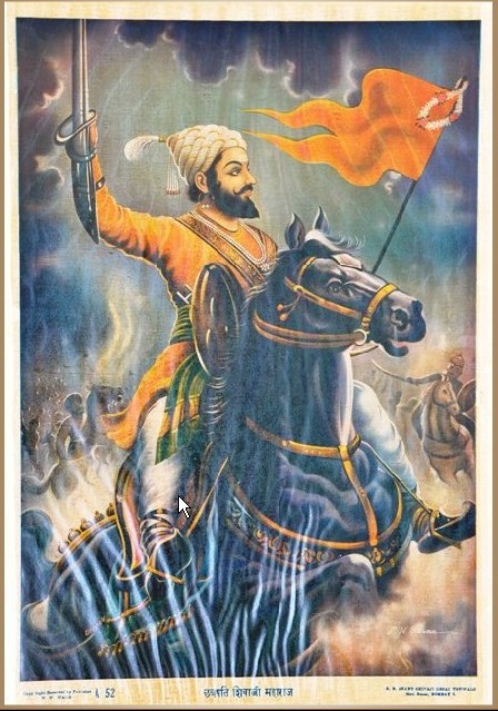
CHATRAPATI SHIVAJI
1. Context
2. Key points
- For a long time in history, before air power took centre stage in military tactics and strategy, forts were crucial to the defence of any country.
- They acted as a force multiplier for the defender and a safe refuge for civilians often the first casualties of war.
- Nowhere is this more apparent than in the Maratha Countryside forts of all sizes and shapes dot the landscape.
- In their heyday, control of these forts translated into control of the territory.
- Chhatrapati Shivaji Maharaj, at the time of his death, is said to have control of over 200 forts across his territories with some estimates putting the number over 300.
- In many ways, the Marathas took fort-building to its zenith, not only building forts capable of surviving long sieges and battles but putting special attention to their placement and locations.
- Grant Duff, a soldier of the East India Company and the first comprehensive historian of the Marathas wrote: "There is probably no stronger country in the world than the Deccan from the military defence point of view".
3. The terrain of the Maratha Country
- Unlike the plains of Northern India, suited to conventional battle with large standing armies, the terrain of the Maratha country was different.
- With the Arabian Sea on one side, the Konkan plains in the centre and the Western Ghats overlooking the plains, in the 17th century much of the region was covered in thick jungles.
- Warfare in such terrain is qualitatively different, with large conventional armies prone to getting bogged down.
- Thus, as Shivaji began to consolidate and expand his influence in the region, his strategies evolved to be significantly different from the common military doctrine of the time.
- Crucial to his military strategy were hill forts.
4. A native of hill forts
- Historian Gunakar Muley called Shivaji "a fort-native".
- The Maratha icon was born and raised in the hill fort of Shivneri (around 100km from Pune), given to his grandfather by the Sultan of Ahmadnagar instead of his services as a military commander.
- Shivneri is a typical hill fort found in the Western Ghats a small but strong fortification, a top hill overlooking the surrounding terrain.
- It had a permanent source of water inside in the form of two freshwater springs and according to some accounts (to be taken with a pinch of salt), the fort was well-stocked to feed its residents for seven years.
| In "Sivaji and the Rise of the Mahrattas" by Richard Temple, M.G. Ranade, G.S. Sardesai, R.M. Netham and James Douglas and Shivneri is described as the following: "You will see what a rugged precipitous place this is and what a fitting spot it was for a hero to be born!". |
- Thus, growing up in the hills and valleys around Pune, Shivaji understood the salience of hill forts in controlling the land.
- Over his storied life, he captured multiple such forts, including Torna (When he was only 16), Rajgadh, Sinhagadh and Purandar.
5. Shivaji's guerilla tactics
- Shivaji's armed forces had some major limitations.
- First, he did not have the man or horsepower compared to most of his enemies, especially during the early stages of his life.
- Second, he was heavily reliant on obtaining supplies such as muskets and gunpowder from the Europeans, mainly the Portuguese.
- This meant that in conventional battle, he would have seldom stood a chance against his foes.
- Thus, Shivaji adopted guerilla tactics: his men would travel in small, highly mobile and heavily armed attachments, wreak havoc in the often sluggish Mughal or Adil Shahi armies, loot supplies and treasure and quickly retreat.
- Crucial to such plans were hill forts. Marathas forces would strike quickly and retreat to the many hill forts of the region.
- These forts were designed such that the approach to them was tricky, often treacherous, to large groups of men.
- Consequently, these were perfect defensive positions where either the bigger armies would not bother to attack or would have to sacrifice their strength in numbers if they did choose to attack.
| Hill forts also were constructed such that they were perfect vantage points to keep a lookout for any threat. "There should not be a higher point near the fort amongst the surrounding hills," wrote Ramchandrra Pant Amatya, Shivaji's Finance Minister. |
- Often, if there were higher points nearby, smaller forts would be constructed there.
- This can be seen in the case of the Purandar fort, which is flanked by the smaller Vajragad fort.
- What hill forts effectively allowed Shivaji to do was project his power, beyond what would have been possible through conventional means.
- The relative safety of his forts allowed him to successfully carry his lighting tactics while fighting formidable enemies.
- As his territories grew, these forts became all the more important, as local strongholds and seats of local administration.
- From forts nestled atop great heights, he could govern the land around. They also became symbols that projected his power and presence.
- The Maratha Empire emerged from humble beginnings. While a variety of factors, concerning both the Marathas and their rivals, contributed to their rise, the significance of hill forts cannot be overlooked.
|
For Prelims: Chhatrapati Shivaji, Maratha Empire, Guerilla Tactics, Mughal Empire
For Mains:
1. Why were forts so important for the consolidation of the Maratha Empire? discuss the uniqueness of these forts. (250 Words)
|


